Land For Sale In Wadi Al Foraa Neighborhood
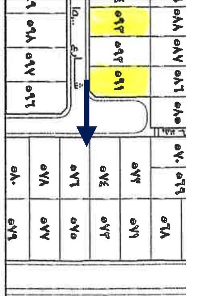
Residential plot No. (578) located in the Ray’ Malah residential plan from plan No. 919/W/1422 in the Wahmal branch governorate.
Its borders and lengths:
North: Plot No. 577, 2020 square meters long
South: 15-meter-wide street, 2020 square meters long
East: Plot No. 580, 4040 meters long
West: Plot No. 576, 4040 meters long
Area: 800 square meters
The branches are Al-Yatma and Abyar Al-Mashi, Al-Mundasa, and Al-
Suwaidrah, Al-Hanakiyah.
Branch
Merchant: 110 Thousand SAR.
Residential : 75 Thousand SAR.
Property Information
- TypeResidential Land
- PurposeFor Sale
- Bayut IDBayut - 87767410
- Added on22 September 2025
Features / Amenities
Maid Room
Swimming Pool
Jacuzzi
Sauna
+ 47 more amenities
REGA Verified Information
- FAL License Number1100206708
- License Issue Date22 September 2025
- License Expiry Date23 July 2026
Ad Responsible Info
- Responsible Name-
- Responsible Number-
Location
- Regionمنطقة المدينة المنورة
- CityWadi Al Foraa
- District-
- Street Name15
- Postal Code44922
- Building No3508
- Additional No9302
- Latitude23.487839505146706
- Longitude39.84117812075684
Property Specs
- Advertisement TypeFor Sale
- Listing Usage-
- Listing TypeResidential Land
- Price75200
- Area Size800
- Number of Rooms-
Utilities
- ElectricityYes
- SewerageYes
- Fixed PhoneYes
Additional Information
- Listing Age-
- Street Width15
- Plan Number919 / و / 1422
- Deed Number760001041010
- Listing FaceSouthern
- Borders and Lengths-
- Guarantees and Duration-
- ChannelsLicensed platform, Bulletin board, Social media platforms, Radio, Other
- Obligations on Listingلا يوجد
- Compliance with Saudi Building Code-
- Is Listing PawnedNo
- Is Listing ConstrainedNo
- Land Number578
- Notes-
Property Borders
- Nameقطعة
- Descriptionرقم 577
- Lengthعشرون متر
- Nameقطعة
- Descriptionرقم 580
- Lengthأربعون متر
- Nameقطعة
- Descriptionرقم 576
- Lengthأربعون متر
- Nameشارع
- Descriptionعرض خمسة عشر متر
- Lengthعشرون متر
North
East
West
South
Loan Calculator
Location & Nearby
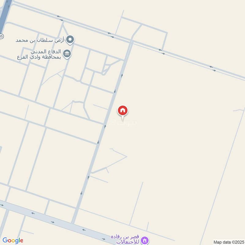
The location is fetched and verified by REGALocation Description as per Deed:قطعة الأرض السكنية رقم ( 578 ) الواقعة فى مخطط ريع ملح السكنى من المخطط رقم 919 / و/ 1422 بمحافظة وادى الفرع .
See location
Agent:Hassan Kabi
Beware of fraud, Transfer through official channels. Posting on behalf of others leads to legal liability.

