Every city, mountain, and coastline in Saudi Arabia tells a story hidden deep within the earth. The Saudi Geological Survey Authority (SGS) is the institution that uncovers those stories, transforming rocks, minerals, and terrain into data that shapes how the Kingdom grows.
Founded in 1999 under the Ministry of Industry and Mineral Resources, SGS leads geological research, mineral exploration, and hazard monitoring. Its work helps Saudi Arabia build safer cities, expand industries, and plan for a sustainable future under Vision 2030.
What does the Saudi Geological Survey Authority do?
The Saudi Geological Survey Authority (SGS) is the Kingdom’s national agency for earth-science and environmental research.
Its main responsibilities include:
- Studying land formations and geological structures.
- Producing geological maps and maintaining national data.
- Monitoring geological hazards such as earthquakes, landslides, and volcanic zones.
In simple terms, SGS ensures that every development project in Saudi Arabia starts on solid and secure ground.
Note: In October 2025, the Saudi Geological Survey Authority released new geological data packages covering major parts of the Arabian Shield. These updates will help engineers and planners assess land stability, water availability, and mineral resources before launching new development projects.
Objectives of the Saudi Geological Survey Authority
The SGS plays a vital role in both scientific advancement and national development. Its objectives include:
- Creating and updating geological maps and maintaining the national geoscience database.
- Exploring minerals and groundwater to strengthen the mining and water sectors.
- Monitoring geological hazards such as earthquakes, volcanic activity, and landslides.
- Offering geotechnical studies for infrastructure and urban expansion.
- Supporting Vision 2030 through innovation, research, and digital transformation.
Each goal aligns with Saudi Arabia’s broader push for sustainable growth and smarter city development.
The Blueprint beneath Development
Accurate mapping is at the heart of SGS’s mission. These maps help identify mineral zones, groundwater sources, and safe land for major projects.
Geological maps developed by SGS help to:
- Locate mineral-rich belts across the Kingdom.
- Assess groundwater potential in arid regions.
- Evaluate land stability before construction begins.
Did You Know?
The SGS is now using AI technology from KAUST to monitor earthquakes and geological activity in real time. It is ensuring safer foundations for new cities and residential zones.
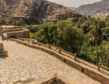
Discover how SSG balances mountain regions like Al Baha with Bayut-KSA.

Managing Geological Hazards
Saudi Arabia’s earth includes fault lines, volcanic fields, and mountain zones. SGS continuously studies these areas to prevent risks that could affect communities or construction projects.
Monitored hazards include:
- Earthquakes and fault movements.
- Volcanic activity in western Saudi Arabia.
- Landslides, subsidence, and rockfalls.
- Groundwater depletion and soil erosion.
This early detection and analysis ensure that cities expand safely while protecting residents, property, and infrastructure.
Saudi Geological Survey Authority Academy
Beyond research, SGS also invests in people. Its training programs and scientific workshops build local expertise in geology, engineering, and environmental management.
Focus areas include:
- Developing Saudi scientific talent through field training.
- Promoting innovation in environmental monitoring.
- Enhancing knowledge-sharing with universities and industry partners.
These initiatives create a stronger national foundation for technical skills, a key pillar of Vision 2030’s knowledge-based economy.
Partnership with Ministry
SGS operates under the Ministry of Industry and Mineral Resources, aligning its work with Saudi Arabia’s plans for industrial and economic diversification.
This partnership aims to:
- Attract investment in mining and exploration.
- Advance geological research and innovation.
- Support transparent and accessible data systems for decision-makers.
As Saudi Arabia climbs global ranks in mining investment attractiveness, SGS’s research is also guiding urban expansion and industrial zoning. It is helping the Kingdom balance natural resource exploration with sustainable community growth.
Bayut-KSA: Connecting Progress to place
As Saudi Arabia advances in science, mining, and infrastructure, new opportunities emerge across its cities and regions. Every successful project begins with a strong foundation, and so does every home, community, and investment.
Trust Bayut-KSA in connecting this national progress to real-world opportunities!